To begin with, I’m
addicted to travelling and this trip that I’m going to pen down now, goes back
to 2016. Like every other year, this time also there’s plan for a long trip. A
fortnight October trip at Lahaul-Spiti is
what we had started to plan since April. As for “we”, that’s 6 members in the
group – my parents and me along with the family of my father’s office
colleague.
Before going in to the
journey details, let me acquaint the readers with Lahaul-Spiti
district. It is a district in Himachal Pradesh,
India with the administrative centre at Keylong.
The district was formed in 1960 by combining two formerly separate districts of
Lahaul (capital was Kardang) and Spiti (capital was Dhankar). Another important
information about this district is its being the fourth
least populous district in India with a population of 31,564 and density
of only 2.3/km2 (Census 2011). There are further mind-blowing
information about the district that I shall share as I go through this
travelogue.
October 8: Kolkata to Chandigarh... We are in Poorva Express on our way to New Delhi from Howrah. We reach New Delhi on the 9th
and off to Chandigarh by New
Delhi-Chandigarh Satabdi Express. A night stay at Chandigarh and our road trip
begins the next day.
October 10: Chandigarh to Manali... Early morning and our guide-cum-driver Rakesh
Thakur (Rakesh-bhaiya for the rest of the tour) is there with his white Xylo. Our first destination is Manali at a
 |
| Kash flowers on the way to Manali |
distance of around 300 km from Chandigarh. It’s a cool October
morning and we are off. The road crosses many irrigation canals and the
roadsides are full of Kash flower
shrubs. Breakfast of hot aloo parathe and tea at a roadside dhaba amidst the
cool surroundings feels like heaven. And we are back in our car winding through
roads as the height increases gradually. We enter Himachal Pradesh and our next sighting is the Gobind Sagar
 |
| Gobind Sagar Lake |
Lake, reservoir of the Bhakra Dam. It is on the Sutlej
River and is situated in Una and Bilaspur districts of Himachal Pradesh.
Another halt at a roadside
eatery for some light lunch and here we come to see a religious procession
walking rather purposefully at a brisk pace. A couple of guys are carrying what
seemed like a palki (palanquin), while some of the others are carrying Himachali folk musical instruments. The palki is not the typical veiled
box type. It is an open small platform with deities of gods and goddesses in
all its religious regalia perched on top. We are informed by
Rakesh-bhaiya that they are on their way to Kullu for the Dussehra festival. Based on legendary stories, “Maharishi Jamdagni was returning from a
pilgrimage when a violent storm brewed up. The storm imbalanced him and the idols of gods
that he was carrying over his head in a basket got scattered in different areas
of the valley. Since then, the deity worship began in Kullu Valley and as an
annual ritual, these deities keep on assembling in Kullu on Dussehra since the last few
centuries or so.” It is a beautiful sight and
with those instruments, it creats a festival like event. It is worth noting how these
 |
| The deities and the procession to Kullu for Dussehra |
people walk miles after miles uphill and downhill for the annual
event. With our lunch complete in the meantime, we start for the last lap of journey for that day. We reach Manali at afternoon where we
 |
| At Manali Mall |
already have our rooms reserved at Hotel
Sagar. With our luggages dumped in the hotel rooms and some
freshening up, we are ready for a brief afternoon stroll at the Manali
Mall. The mall is crowded with commoners and tourists.
There are lots of shops selling woollens and you can buy some quality stuff
after a little bargaining which will be handy for the rest of the tour. With
the sun going behind the mountains, it’s time to get back to hotel, have some
food and a good sleep. The next day is going to be a long and tough one as we
shall head for Chandratal.
October 11: Manali to Chandratal... It’s pitch dark outside and
we start our journey at around 4:30 am. Chandratal is almost 150 km away from Manali and the journey is through Rohtang
Pass. There are
 |
| View from Rohtang pass check post |
some timing issues for reaching the
Rohtang Pass check-post as informed by Rakesh-bhaiya and hence, the early
starting. We reach the check-post at around 7:30 am after coming 40 km uphill
and are welcomed by the scenic snow-clad mountain peaks with golden sunrays
from the early morning. A hot cup of tea
at a roadside shanty amidst the cool atmosphere, with the picturesque view all
around gives inner peace to us. Some official work at the check-post and we
start for our journey ahead. We reach Rohtang Pass but are shocked to find not
an inch of snow anywhere, something quite disheartening. A few minutes there
and we are on the road again. Few kilometres downhill through some landslide-affected
road and we reach Gramphu.
The road diverges at
Gramphu. The straight road from
Rohtang Pass through Gramphu takes you to Ladakh via Baralacha Pass. That’s not our destination though and we need to
take the diversion
that
 |
| Car rally at Gramphu |
will lead us to Lahaul-Spiti. A
car rally is going on and the diversion is blocked. All the cars are stuck and
we try our best to kill time by feeding ourselves and a furry street dog,
climbing up the mountains, taking photos of the surroundings and of ourselves. Finally, it is not before another 4-5 hours of waiting that
we begin our journey towards Chandratal. This road is unpaved and it leaves back a cloud of dust as the car plies
on. After an 80 km bumpy ride through
this road via Chhatru
and Batal, we are finally at the Chandratal valley.
There is no
hotel here for staying. The only accommodation available is tent. Under the name of Parasol
 |
| Mountain Sparrows at the Parasol Camps |
Camps, series of swiss tents are on rent throughout the valley, surrounded by
snow-capped mountains on all sides. There is no electricity, there’s immense cold and the strong cold breeze makes you shiver to the bones. It seems to be a place
out of the world, away from civilization and in the lap of raw nature. As the
sun sets, there is pitch black darkness all around. A common tent in the middle
is all that is lit and all the tourists gather there around a bonfire as we
have our dinner at 8 pm. It is tremendous cold outside and the proprietor of the
camp informs us that on an approximate, the minimum temperature remains the
negative of the date in October. So, that particular night it is almost a
chilling -11OC.
There is nothing much to do post dinner except for star
gazing amidst the darkness and chilling
winds. Night inside the tent is an experience indeed. You can feel the chill no
matter how much blanket you are using. And the strong winds will make you feel
as if the tent can be blown away any instant. With the tiredness after the entire
day of hectic journey, our eyes are heavy and we are in deep slumber.
October 12: Chandratal & Chandratal to Kaza... I’m an early riser by
default, and when in the mountains I tend to rise earlier to take in the fresh
air and serenity all around. At 4:30 am, I am up from
 |
| The first rays |
bed and to my utter
disbelief I find the entire bucket of water frozen and so has the water inside the tap. I have to break
the ice in the bucket with a steel mug and
use those ice pieces to freshen up. Life is tough over there under such severe atmospheric conditions.
 |
| Chandratal amidst the colourful mountains |
And the next moment, I am outside the tent
waiting for the first rays of the sun on the nearest peak. The meadows and car bonnets are filled with dew which have frozen and there snowflakes on
the car
glasses. One or two birds, withstanding the chillness all
around, are hoping on the grasses and pecking at food leftovers. Around 7 am,
we start for Chandratal Lake. A
few minutes’ drive and then a few kilo-metres trek takes us to a place which can never be
 |
| Lush green waters of the Chandratal |
properly described in words. What seems to be quite a normal lake from a distance, literally makes our mouths wide open
at its sheer beauty when we reach
close to it. With clear blue sky and
snow
clad mountain peaks all around the lake, at a
height of 14100 feet
above sea level, provides a complete reflection in the early hours of morning. We stand in awe
allowing the beauty to sink in and realizing how beautiful nature is. You find different
shades of color in the lake water when you
look at it from different angles, sometimes it’s blue and sometimes lush green. Once the wind starts
blowing, ripples in the water prevent you from the beautiful sight. So an early
morning visit to the lake is a must as
the wind speed remains less.
 |
Panoramic view of the Chandratal
|
 |
| At the Chandratal |
We return to our tents
after the Chandratal visit and start for our next destination Kaza, approximately
 |
| A windy Kunzum Pass |
approximately at a distance of 80-90
km. Our first stop is the Kunzum Pass at 14931 feet above sea level which connects Lahaul
valley with Spiti valley. The Kunzum pass is surrounded by snow-capped
mountains. A brief halt there and we are again on the roads. The demography of
this region is quite different from the normal mountains available throughout
India. In this region, mountains are
 |
| Wind sculptures on the arid mountains |
arid and there is no green cover. The absence of greenery brings out the various
colors of the mountains which are otherwise not visible, thus adding to the
beauty. The river beds are
also almost
dry here and the rivers narrow. In the absence of any trees and vegetation, the strong
winds cut through the bare rocks on
the mountains to create various sculpture like
figures. Spiti valley is a cold desert having close similarities in
demographical features with the neighbouring Ladakh and Tibet. The road winds through beautiful artistic
arid mountains, canyons and valleys. Yaks and mules grazing on the river beds and valleys are a common
sight in this part of Himachal Pradesh. At
 |
| Spiti river basin surrounded by mountains |
afternoon, the Spiti
River starts accompanying us and finally we reach Kaza at around 5:30 pm after crossing a long bridge over
the river. We have our rooms reserved at Parasol Retreat which overlooks the river on one side and the mountain
on the other side. The proprietor, Bishan Thakur, of the Parasol Camps at Chandratal has reserved two
rooms for us at his own Parasol Retreat, Kaza. Kaza, at a height of 11980
feet above sea level is the largest township and
commercial center of the Spiti valley. Enough
of journey for that day and we have the next day for doing the local
sight scenes at Kaza.
 |
| Arid mountains, on the way to Kaza, with shadows of clouds adding to the beauty |
October 13: Kaza... We wake up to a beautiful
cool morning much different than the immensely cold one of the previous day. We
shall be staying at Kaza and touring the local sight scenes. After breakfast,
 |
| Spiti river basin from the top of Kaza |
we are once again in our car, moving up the mountains. On the way, we are
informed by Rakesh-bhaiya that in the winter season, snow
leopards may be found resting on the
roadsides in this region. As we move winding up the mountains, the entire Spiti
river basin is visible which looks
like a canvas picture. With the narrow streams
flowing through the river bed, the blue
sky and the colourful mountains on all sides, it seems to be no less than a painting.
This area is rich with different types of birds like the yellow-billed chough, red-billed chough, Himalayan chukar and many more.
 |
| Yellow-billed Chough Himalayan Chukar |
The first place to visit is
the Langza
valley. Langza is situated at a height of 14,500
feet above sea level and is famous for the availability of natural
fossils. We get down from our car and spend some time
 |
Searching for fossils at Langza with peak
Chau Chau Kang Nilda at the backdrop |
roaming
in the valley searching for fossils. It is a rocky valley with narrow streams
of water flowing in places. Small shrubs with thorns cover the colorful rocks
making the place more beautiful. We
 |
| Natural fossil at Langza |
come to know that this place is often
invaded by snow leopards and we also find the carcass of a yak, most likely to be a prey of some predator. We wander in the pastures
looking at yaks grazing on the thorny shrubs and looking for fossils. Mostly, the local kids take
away the fossils and sell them to tourists for earning their livelihood. We are
lucky though to find a fossil from the valley itself, indeed a new experience.
Our next stop is Komic which, at a height of 15050 feet is the world’s highest
village connected through
 |
| My parents at Komic |
motorable road.
As of 2016, the total population of the village is 114 only. The village has a few single storeyed houses
with thatched roofs where the local people are storing different things to be
used for the oncoming winter season. There is also a small monastery at the
 |
| Hikkim village as seen from Komic |
middle of the village which is surrounded by mountains. It is very cold out
there, with chilling winds blowing from every direction. At a lower height and
visible from Komic is another village by the name of Hikkim. At an elevation of 14400 feet above sea level, Hikkim has the highest
post office in the world, connecting small villages
in this isolated area to the rest of the world, incredible India indeed.
The last spot to visit for
that day is the Kye (pronounced as Kee) Gompa which is a Tibetan Buddhist
 |
| Kye Gompa |
monastery on the top of a
hill at a height of 13668 feet overlooking
at the Spiti River. Built in the 11th
century, the Kye Gompa has its walls covered with paintings and murals. It has
a rich collection of books and Buddha images from the early centuries. It
houses around 250 monks who reside within the sacred walls throughout the year.
The Kye Gompa provides an artistic view of the Spiti River flowing beneath. While
returning from Kye Gompa, you can also have a visit to Kibber which is a small village on the lap of mountains. At
a height of 14010 feet above
sea level, it used to be previously the highest village in the world, connected through motorable road. Kibber is
 |
| Spiti River |
presently the
most populated village there with 366 residents. We do not have time and so
with a view of Kibber from a distance, it’s time to go downhill. Rakesh-bhaiya
takes us to the Spiti River bed where he gets his car cleaned as we enjoy the
cold freezing water and the beautiful scenery all around. It’s now time to go
back to the hotel and get ready for more travel the next day.
October 14: Kaza to Nako through Tabo... A sunny morning and it’s
time to bid adieu to Kaza. Luggage packed and we are on our way for a new
destination. The road goes downhill just beside the
 |
Contrasting colors of trees
and mountains |
river and at times goes
uphill till the very top. The hills over here have more wind sculptures. The
hills are fully brown or black depending on the rock textures and at some
places you may find a tiny hut out of nowhere. These huts have
a tree or two with its colorful yellow-green leaves, increasing the contrasting
features and intensifying the natural beauty. A point of time we are
driving just beside the Spiti River and
 |
| Dhankar Gompa |
the next moment we are going uphill to the Dhankar Gompa. At an elevation of 12774 feet above sea level, the gompa, perhaps, has the best
location overlooking the confluence of
the Spiti
River and the Pin River. The Dhankar Gompa is over 1000 years old and is located between the rocky spurs at thetop of
cliff. It houses almost 150 monks and has a large prayer room at the centre
having a statue of Dhayan Buddha with
four figures seated back to back. However, the height of the prayer room is
very small and I have to almost bend down to my waist to enter it. From the
Dhankar Gompa, the confluence
 |
Confluence of Pin River (from the left) and the
Spiti River (from the right) |
of the Pin River (from the Pin valley) and the Spiti River (from the Spiti valley) provides an enchanting view soothing both the eyes
and the mind. After a brief halt at the Dhankar Gompa, we again go downhill and
are at the same elevation as the Spiti River. At a particular place,
Rakesh-bhaiya stops the car and takes us to a tree below which the rocks are
shining in the sunlight. We observe that the latex from the tree is dropping on
the rock and we also taste the sweet latex coming out of the tree. It tastes
like honey and the sugary texture of the latex creates the shine on
the rocks below. The name of the tree is unknown to us but it is worth an experience. |
| Investigation of the tree, secreting sugary latex |
Our next stop is the Tabo
Monastery. Located at a height of 10010
feet above sea level, the monastery is
 |
| Central Stupa inside the Tabo monastery |
at the bottom of a
valley unlike other monasteries which are perched on hills. It is unfortunate
for us that the monastery is under maintenance and we are not allowed to enter
inside the main buildings. All that we are allowed, is to have a look from the
outside and roam in the courtyard. There is a Stupa at the center of the
courtyard. Tabo monastery has a
canteen inside and with nothing else to do, we have our lunch over there. You
can stay in Tabo which is a picturesque small village. However we are short in
time and without staying there we move forward to our next location. Tabo has a
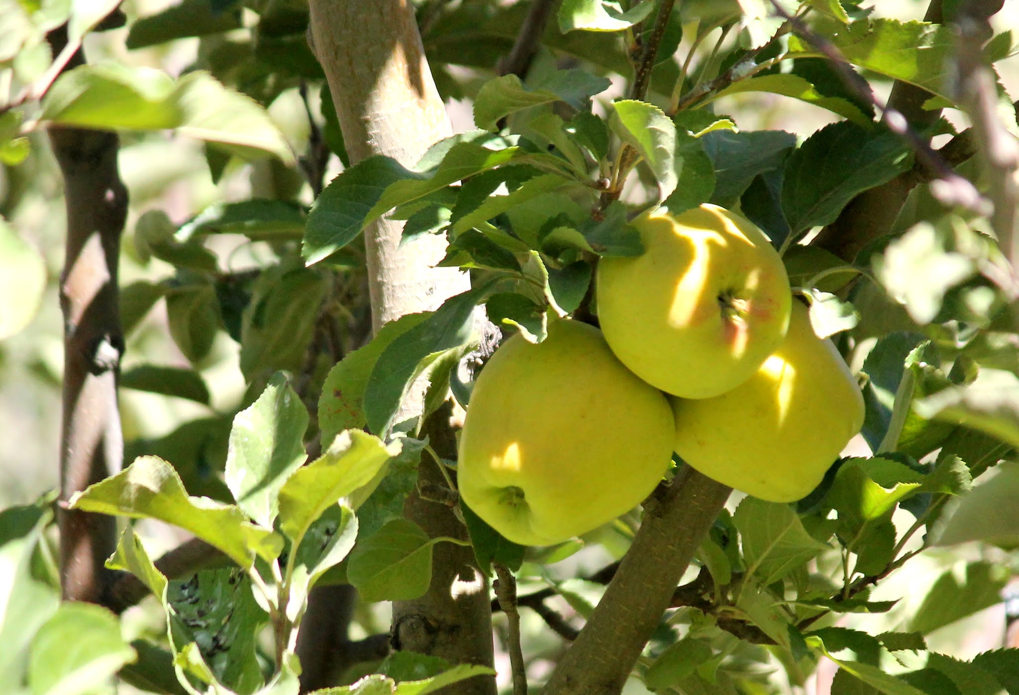
number of apple orchards and
the road goes through orchards on both sides. It is indeed a sight to watch.
Rakesh-bhaiya stops the car in front of an orchard and we enter inside it.
There are trees of red apples and
golden
apples in the orchard. The workers in the orchard are found
to dump baskets of apples which are to be taken to market. They eagerly allow us to
 |
| Golden apples in an orchard in Tabo |
have some from the collection. The apples are immensely juicy and sweet
and is bound to fill up your stomach in no time. These workers are so polite
that they deny taking any monetary benefit against the apples they gave us and we have to literally force
them to accept the bare minimum monetary help. A message to all readers and
tourists, try to help them through some monetary aide even if they deny. You must
not take chance of the politeness of these hardworking people but help them in
return.
As we continue to drive to
our next destination, Nako, at a certain place Rakesh-bhaiya stops the car all
 |
| Blue sheep climbing the steep cliff |
of a sudden and informs us that on the cliff on the other side of the river
there is a herd of blue sheep.
We are taken by surprise realizing how it is possible for him to see those
creatures which are at least 300 to 400 metres away and that too while he is
driving. And indeed there are these blue sheep jumping from one boulder to
another on the steep hillside. These sheep have their hooves grooved at the centre
helping them to climb almost vertical steep slopes. In addition, the colors of
the sheep and the rocks are almost the same aiding the sheep to camouflage
themselves from predators. Amidst this arid and dry weather, they move across
the vertical cliff to graze on the minute grasses and to lick the salts from
the boulders that are sources of minerals. Few photos of the animals at a
distant,
 |
| Nako Lake |
some words of praise for Rakesh-bhaiya and we finally reach Nako at afternoon after an almost 120
km ride. We do not have any
hotels reserved over here and we board a local hotel with a beautiful view of
the mountains outside. We shall be leaving Nako the next morning and with
luggage inside our hotel rooms, we go outside to visit the Nako Lake. At an altitude of 12014 feet above sea level, it is a small lake
with willow and poplar trees and mountains
surrounding on all sides. My father informs us that the beauty of the lake has
degraded to a large extent since his earlier visit in the early 1990’s. Nako is
a halt point for us to spend the night. However there are many more tourist
spots in Nako which we are unable to visit due to shortage of time.
October 15: Nako to Kalpa... Another day and we get ready for another journey, this time to Kalpa at
 |
| View from Nako monastery |
a distance of almost 100 km from Nako. We start early morning after a
light breakfast. Our first stop is the Nako monastery where we offer our
prayers before starting the long journey. From the road outside the monastery,
you get a beautiful view of the colorful arid hills. The hills
 |
| Hanging roof over road |
are vibrant in
colors and at the valley towards the bottom, there are plantations and vegetation. The contrast in colors is worth enjoying. Life is
difficult in such places amidst this aridity, but people have found ways and started
cultivation for daily needs. There is not any tourist spot on today’s route
except the hanging mountain rooftop on the road. Lots of appraisals for the
 |
| Sunset over Kinnaur Kailash range |
Border Roads Organization (BRO) for maintaining
these roads and also creating such beautiful notable sights on the roadsides. As we move towards Kalpa, Rakesh-bhaiya informs us that
according to local mythology, the Pandavas used to stay here for a large time during
their period of disguise. Near to Kalpa, there is a Buddhist temple with a very tall Buddha statue.
There are gardens of roses and other unknown flowers at the feet of the statue.
We reach Kalpa in the afternoon and we have our rooms reserved at the Kinnaur Villa. The location of the hotel is beyond
description. It faces the snow-capped Kinnaur
Kailash range and you can see the Shivling Peak
in front on top of which is the Shivling Rock
that changes its colour at different times of the day based on the angle
of sunrays. We are just in time to experience an amazing
sunset over the snow-capped mountain peaks. It being a full moon night
we remain awake amidst the chilling wind to catch a glimpse of the moonlight on
the peaks, but to our disappointment, the moon rises from behind the mountain
range and all our efforts are in vain. Tired after the day, it’s time to have a
sound sleep.
 |
| The Shivling peak at the middle with the Shivling rock at the top, rising vertically upwards, at daytime and at sunset |
October 16: Kalpa... It is a day of rest and some local sight scenes at Kalpa. Enjoying the
morning sunrays at a height of 9711 feet above
sea level and chewing on some juicy fresh apples is indeed a
 |
| View from Kalpa Suicide Point |
luxury.
Post-breakfast, Rakesh-bhaiya is back to take us through the roads of Kalpa.
The first stop is the Kalpa Suicide Point.
The place indeed has a very steep slope downwards but with the beautiful view
all around, I really doubt if anyone shall take a chance to sacrifice his life from
there. There are a number of apple orchards by the roadsides and village boys
are found to sell apples at quite a cheap rate. We just keep on walking along
the isolated roads breathing in the fresh air and
 |
Wooden carvings at the
Durga Temple |
enjoying the beauty all
around. The mountains over here are no more arid and there is lush greenery all
around. Few more minutes of strolling and our next destination is the Durga Temple. For some unknown reason, the temple is closed on the
 |
| Royal apples in an orchard |
day and we have nothing else to do but to return to our
hotel for lunch. On our way back we enter some apple orchards and decide for
buying a carton of apples for taking them home. The red apples are named as Royal Apples over here and, as informed, these are
mainly exported to foreign countries. We are also informed that Golden Apples
do not remain good with so many days under packed condition and is not a proper
choice for taking to Kolkata whch is at a very hot and humid. Back in hotel, we enjoy the rest of the day leisurely
as we get ready for the next day’s journey to Sangla.
October 17: Kalpa to Sangla and Chhitkul... We are coming towards the end of the trip and it’s time
 |
| Scenic view on the way to Chhitkul |
to move further
down to Sangla at a distance of a mere 40 km from Kalpa. Near Sangla, there are a number
of hydel power plants on the Baspa River and the entire area is more of a
township with quarters and schools and offices for people related to the hydel
projects. Situated at a height of 8600 feet above
sea level, Sangla is close to the Indo-Tibetan
border and is on the banks of the Baspa River. We reach Sangla at around
noon and check-in our already reserved hotel. With luggage kept inside our rooms, we get ready to visit Chhitkul, the last
village on the old Hindustan-Tibet trade route. Located 24 km away from Sangla beside the Baspa River, it is
also the last point in India in this routewhere one can travel
to without a permit.
 |
| Baspa river at Chhitkul |
At Chhitkul, we go down to the river enjoying the
beauty and clean air all around. The ice-cold river water is flowing through
the boulders and the banks are full of pine and cedar trees. The snow-capped
mountains at the backdrop and the clear blue sky add to the overall beauty of the place. It
feels as if the place is somewhere out of this world. No wonder why a recent
study showed that Chhitkul has the cleanest air in
India. An hour at Chhitkul and, next we are returning to our hotel at
Sangla for lunch. There’s nothing more to do at Sangla and we spend the evening
gossiping with Rakesh-bhaiya about his travelling experiences.
October 18: Sangla to Narkanda via Sarahan... Early morning and I’m out for a casual stroll on the
 |
| Early morning at Sangla |
streets of Sangla.
The sun has just risen but the moon is still visible. I enjoy viewing the soft
rays of the sun kissing the mountain tops as I realise that it will be months
before I shall be experiencing such a view again. Sadness creeps in but that is
life. Bags packed and we are ready to travel to Narkanda
around 170 km away. As we move downhill,
Rakesh-bhaiya informs us that |
| Bhimakali Temple at Sarahan |
the hills in these areas are prone to landslides. He also shows us that a previous road is totally devastated by landslide and we
need to take a diversion. Our first stop is Sarahan
which is almost the midway between Sangla and Narkanda. At a height of 6900 feet above sea level, Sarahan is famous for
the Bhimakali Temple which is one of the 51 Shaktee Peethas. The temple is entirely
made of wood and stones and it houses both Hindu and Buddhist statues and decorations reflecting
the trade through here between Indian and Tibetan regions. Sarahan is a
wonderful place to stay also. But, staying here is not in our schedule and so, after puja at the
temple and a casual stroll, we are back in the
 |
| Red-headed Indian Vulture |
car. A few
kilometres on the road, and once again Rakesh-bhaiya stops the car because
there is a red-headed Indian vulture sitting
on a rock in the gorge by the road. We get out of the car to take photos and
find the vulture sitting over the corpse of a cattle. No further halt on the
route except for lunch and we reach Narkanda at afternoon. We do not have
hotel rooms reserved over here and luckily, we find rooms available at Hotel Hatu which is maintained by the Himachal Pradesh Tourism. The hotel is still under
construction but the surroundings are awesome. As darkness creeps in, our tired bodies
crave for some sleep for the last time in this trip on the lap of the
mountains.
October 19: Narkanda to Chandigarh... The last day of our trip begins with a morning walk on the meadows in
front of the hotel, trying to take in the freshness and unpolluted air as much
as possible.
 |
| View from Hotel Hatu at Narkanda |
The hotel is surrounded by pine and
cedar trees and the clear blue sky increases the beauty. Post breakfast,
we are ready to move to Chandigarh around 180 km away. The route is through Shimla and we are astonished to find the miserable
condition of Shimla. Once, the queen of the Himalayas, it has been reduced to a
sad state due to overpopulation and overpollution. We hardly find any green
cover on the mountains but it is all concrete buildings everywhere, a truly
disheartening condition for a mountain lover like me. Further down, we see that
hills are being blasted to make way for wider roads
to accommodate heavier traffic. We
reach the plain lands and we are at Chandigarh by dusk. It’s time to bid adieu
to Rakesh-bhaiya for a memorable trip as our journey comes to an end.
In the next few days, we
reach New Delhi from Chandigarh by the Satabdi Express and then to Kolkata by
the Rajdhani Express on October 22, 2016. A beautiful trip ends leaving behind
memories and photographs that are to be cherished forever.
Some more helpful information
about this trip:
- Check the weather before planning for
this trip. Carry enough woollens for sub-zero temperatures.
- Chandratal usually remains closed for
tourists after 20th October every year.
- There may be breathing issues due to
the immense height and lack of plantation. Tourists with breathing problems
need to plan accordingly
- Plan for staying at Chhitkul and not
at Sangla
- If you are not going with a travel agency, contact some local person involved with transport. You need to get a lot of permissions
for crossing various check-posts which are
to be done by that person.
- Go for a heavy vehicle for this route
- The distances from one spot to another are quite long and there are few
eateries. Dry fruits and dry food are a must
in such long drives


Comments
Post a Comment